Geophysics in Aberdeen plays a critical role in de-risking ground investigations across a city built on a complex geological tapestry of granite, glacial till, and alluvial deposits. This category encompasses a suite of non-intrusive survey methods designed to map subsurface conditions without the need for extensive excavation, providing essential data where traditional boreholes and trial pits may fall short. From identifying buried bedrock profiles to assessing soil stiffness for seismic design, applied geophysics bridges the gap between sparse point-source data and the continuous ground model required for safe, efficient engineering. In a region shaped by Quaternary glaciation and underlain by the tough crystalline rocks of the Dalradian Supergroup, understanding the lateral and vertical variability of the ground is not just a technical exercise but a fundamental project requirement.
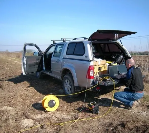
Aberdeen's local geology presents a classic 'hard-soft' dichotomy that geophysical surveys are uniquely equipped to resolve. The city centre and much of the coastal strip are draped in variable thicknesses of glacial till, sands, and gravels, often overlying a highly irregular granite bedrock surface. This buried rockhead can feature steep-sided troughs, weathered zones, and corestones that pose significant challenges for foundation design and piling. Further inland, the Deeside and Don valleys contain softer alluvial silts and clays with lower bearing capacities. Complementing intrusive investigations with techniques like electrical resistivity / VES (Vertical Electrical Sounding) allows engineers to map these transitions efficiently, differentiating between saturated clays, granular aquifers, and highly resistive granite over large areas.
Compliance with UK regulatory standards is mandatory for any ground investigation in the Aberdeen area. All geophysical work must align with the robust framework established by British Standards, notably BS 5930:2015+A1:2020 (the Code of practice for ground investigations) and BS 7022 (Guidance for the application of geophysical methods). For seismic site classification, Eurocode 8 (BS EN 1998-1:2004+A1:2013) dictates the need for shear wave velocity profiling to determine the ground type, a parameter directly addressed by MASW / VS30 (shear wave velocity) surveys. These regulations ensure that data is acquired, processed, and interpreted to a consistent quality, enabling meaningful comparisons between different sites and providing legally defensible data for planning applications and building warrant submissions to Aberdeen City Council.
The requirement for geophysics spans a broad spectrum of projects intrinsic to Aberdeen's economy and infrastructure. The ongoing energy transition, seeing a shift from traditional oil and gas to offshore wind and hydrogen, demands detailed near-surface characterisation for cable routes, substation foundations, and onshore processing plants. Urban regeneration projects on former industrial 'brownfield' sites in Torry or the harbour area frequently call upon seismic tomography (refraction/reflection) to locate buried obstructions, assess rippability, and determine the depth to competent bedrock for heavy crane outrigger pads. Similarly, road and rail infrastructure upgrades, along with residential developments encroaching onto steeper slopes around Kingswells and Westhill, require slope stability assessments informed by accurate subsurface models derived from integrated geophysical surveys.
Common questions
What is the main advantage of using geophysics alongside boreholes in Aberdeen?
The primary advantage is achieving continuous subsurface coverage between discrete borehole locations. In Aberdeen's variable geology, where granite rockhead can undulate dramatically over short distances, boreholes alone can miss critical features like buried channels or isolated boulders. Geophysics provides a 2D or 3D model that connects these points, significantly reducing the risk of unforeseen ground conditions during construction.
How does geophysics help comply with UK seismic regulations for new buildings?
UK seismic design under Eurocode 8 requires classifying the ground type based on the average shear wave velocity in the top 30 metres (VS30). A direct measurement via techniques like MASW provides this parameter accurately. Without it, engineers must rely on conservative assumptions that can lead to a more expensive structural design. This measured data ensures compliance while optimising the foundation solution.
Which geophysical method is best for finding the depth to granite bedrock in Aberdeen?
The optimal method depends on the site constraints, but seismic refraction tomography is highly effective for mapping the transition from softer superficial deposits to hard granite. The large velocity contrast between glacial till and competent granite creates a strong seismic boundary. Where logistical space is limited or the target is deep weathering profiles, electrical resistivity imaging provides a complementary alternative for bedrock profiling.
Can geophysical surveys be conducted on congested urban sites in Aberdeen city centre?
Yes, modern geophysical techniques are highly adaptable to urban environments. While some methods like large-scale seismic reflection require space, electrical resistivity and MASW surveys can be configured with shorter cable spreads to work around buildings and pavements. Non-invasive passive techniques also exist. A feasibility review considering noise sources like traffic and buried services is essential for planning a successful urban survey.