In Aberdeen, what you see at the surface rarely tells the whole story. Glacial till overlies deeply weathered granite across much of the city, and the contact zone can shift within a few metres. That variability catches out standard borehole programmes. An exploratory test pit investigation opens a window directly into the ground, allowing the engineering geologist to log, photograph, and sample the sequence in situ. BS 5930 and BS EN 1997-2 provide the framework, but the real value comes from a technician who knows local drift geology. When the brief calls for a trial pit near the River Dee floodplain, we often pair it with a CPT test to extend the profile below the pit floor without losing stratigraphic context. The combination gives you strength data alongside a visual record of fabric, clast content, and moisture condition.
A single well-logged test pit in Aberdeen’s glacial till provides more geotechnical insight than five SPT boreholes in the same formation.
Our approach and scope
Site-specific factors
Aberdeen sits on a complex Quaternary sequence where the Logie-Buchan Drift Group blankets the underlying Aberdeen Granite Formation. The till is stiff, fissured, and loaded with subrounded boulders up to 1.2 m across. These boulders are the primary hazard for test pit excavation: they mask the true rockhead and create bridging effects that bias the blow counts from nearby boreholes. A pit that terminates on a boulder can give a false refusal depth, leading the foundation designer to underestimate pile socket length. The granite itself decomposes into a micaceous sandy gravel that slumps when saturated. We log the weathering grade using the BS 5930 six-class scale, paying particular attention to Grade III material, which behaves as rock during excavation but degrades to a soil-like consistency under repeated wetting and drying. Missing that transition zone is a common cause of later settlement in pad foundations across the West End.
Regulatory framework
BS 5930:2015+A1:2020 - Code of practice for ground investigations, BS EN 1997-2:2007 (Eurocode 7 Part 2) - Ground investigation and testing, BS EN ISO 14688-1:2018 - Identification and classification of soil, BS EN ISO 14689:2018 - Identification and classification of rock
Complementary services
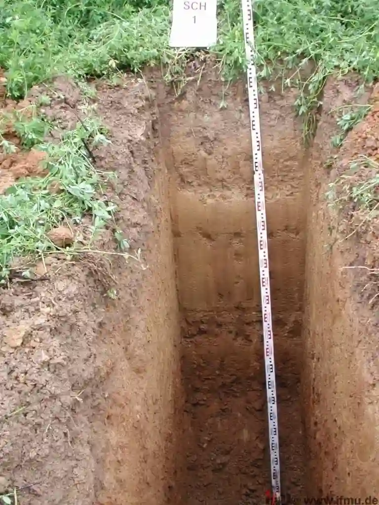
Trial Pit Logging & Photographic Record
Full face logging to BS 5930 with scaled photography of each wall. We record structure, consistency, colour, and clast percentage on site, not from memory.
In-Situ Strength Testing
Hand shear vane and pocket penetrometer measurements taken at each change of stratum within the pit, giving immediate undrained shear strength values before sample disturbance.
Disturbed & Block Sampling
Bulk samples for particle size distribution and plasticity testing. Block samples cut from cohesive till faces where triaxial or oedometer parameters are required by the designer.
Permeability Assessment in Open Excavation
Rising-head and constant-head tests performed directly on the pit floor or in shallow hand-dug sumps. Preferred method for soakaway design under BRE Digest 365.
Typical parameters
Common questions
How deep can an exploratory test pit go in Aberdeen’s geology?
In urban Aberdeen we typically stop at 4.5 m due to buried services and shoring constraints. On open sites away from the city centre, 5.2 m is achievable before the excavator meets refusal on large granite boulders or competent rockhead. BS 5975:2019 governs temporary support requirements, and any excavation deeper than 1.2 m is assessed for collapse risk before entry.
What does an exploratory test pit cost in the Aberdeen area?
Budget between £380 and £660 for a standard trial pit to 3.5 m depth, including machine, operator, logging geologist, and a factual report with photographic panels. Deeper pits, multiple pits on the same day, or those requiring trench sheets for support shift the figure toward the upper end of that range.
Is a test pit better than a borehole for foundation design?
Not better, but different. A test pit lets you see the soil fabric, fissuring, and boulder content directly. A borehole gives you depth and SPT N-values at greater depths. For shallow foundations, retaining walls, or pavement subgrade assessment on glacial till, the pit provides information a borehole log cannot capture. We frequently recommend both methods on the same investigation.
How soon can the pit be excavated after we instruct?
Within five working days for most sites in the Aberdeen postcode area, provided a CAT scan has been completed and any local authority permits for opening the road or footway are in hand. The excavation itself takes one day; the factual report follows within three working days.