Ground investigation in Aberdeen represents the critical first phase of any construction or civil engineering project, providing the essential data required to understand subsurface conditions before design and construction commence. This category encompasses a range of intrusive and non-intrusive techniques designed to characterise soil, rock, and groundwater conditions, ensuring that foundations, retaining structures, and earthworks are designed safely, economically, and in compliance with UK standards. In a city like Aberdeen, where the built environment ranges from historic granite structures to modern energy-sector facilities, a robust ground investigation is not merely a regulatory checkbox but a fundamental risk management tool that can prevent costly over-design, construction delays, or catastrophic failures.
Aberdeen's geological setting presents a unique and often challenging context for ground investigation. The city is famously underlain by the Aberdeen Granite Formation, a hard, crystalline rock that has historically provided excellent building stone but can pose significant challenges for excavation, piling, and trenching. Overlying this bedrock, much of the urban area is covered by complex Quaternary deposits, including glacial tills of varying consistency, glaciofluvial sands and gravels, and post-glacial raised beach deposits along the coastal fringe. These superficial deposits can be highly variable over short distances, with lenses of soft clay or loose, water-bearing sands presenting hazards such as differential settlement or running ground conditions. A thorough understanding of this local geology is therefore paramount.
All ground investigation work in Aberdeen must be carried out in accordance with the relevant UK standards and regulations, most notably Eurocode 7, which was implemented in the UK as BS EN 1997-1 and BS EN 1997-2, governing geotechnical design and ground investigation respectively. The associated UK National Annexes provide country-specific parameters that must be applied. Furthermore, the execution of specific tests is standardised through BS EN ISO 22475, which covers sampling methods and groundwater measurements, and BS EN ISO 22476 for field testing. In Aberdeen, the local authority's building control department will require a comprehensive Ground Investigation Report as a condition for discharging planning conditions related to foundation design, particularly on brownfield sites where contamination might also be a concern under the Environmental Protection Act 1990.
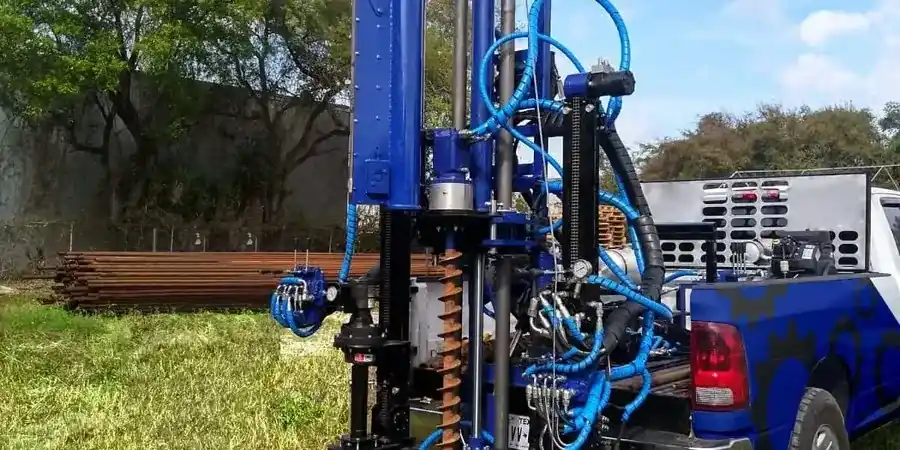
The scope of a ground investigation is tailored to the specific project and the anticipated ground conditions. For smaller-scale residential extensions or the assessment of shallow utilities, targeted methods like exploratory test pits offer a cost-effective way to visually inspect shallow strata and obtain disturbed samples. For most commercial and multi-storey developments, a combination of borehole drilling and in-situ testing is essential. The Cone Penetration Test (CPT) is particularly valuable in the often granular soils of Aberdeen's coastal margins and river valleys, providing a near-continuous profile of soil resistance and pore pressure, which is ideal for pile design and liquefaction assessment. In the hard glacial tills and weathered granite that dominate much of the city, the Standard Penetration Test (SPT) remains the industry workhorse, performed at regular intervals within a borehole to provide both a strength index and a disturbed sample for visual classification. These methods are routinely combined to build a comprehensive ground model for projects ranging from the Aberdeen Harbour expansion to new residential developments in suburbs like Cove and Kingswells.
Common questions
Why is a ground investigation essential before building in Aberdeen?
A ground investigation is essential to identify the highly variable subsurface conditions across Aberdeen, from hard granite bedrock to soft, saturated marine deposits. It provides the data needed for safe and economical foundation design, mitigates the risk of unforeseen ground conditions causing costly delays, and is a standard requirement under UK Building Regulations and Eurocode 7 to discharge planning conditions.
What are the typical stages of a ground investigation in the UK?
A UK ground investigation typically follows a phased approach. It begins with a desk study reviewing geological maps and historical records, followed by a walkover survey. The main intrusive investigation then uses techniques like boreholes and trial pits to recover samples and perform in-situ tests. Finally, a factual and interpretive report is produced, presenting the ground model and geotechnical recommendations.
How deep should a ground investigation go for a standard house extension in Aberdeen?
The investigation depth depends on the foundation loads and geology, but for a house extension, it must extend below all made ground and weak strata to competent bearing material. In Aberdeen, this often means proving the depth to a stiff glacial till or bedrock. A common rule of thumb is to investigate to a depth where the stress increase from the foundation is less than 10% of the original overburden pressure.
Which in-situ test is more suitable for the sandy soils found near Aberdeen's coast, CPT or SPT?
The Cone Penetration Test (CPT) is generally more suitable for the granular, sandy soils common along Aberdeen's coastline. It provides a rapid, near-continuous profile of soil resistance and pore water pressure, offering superior data for assessing liquefaction potential and designing driven piles. The SPT can be used in these soils but provides data at discrete intervals and is more disruptive.